

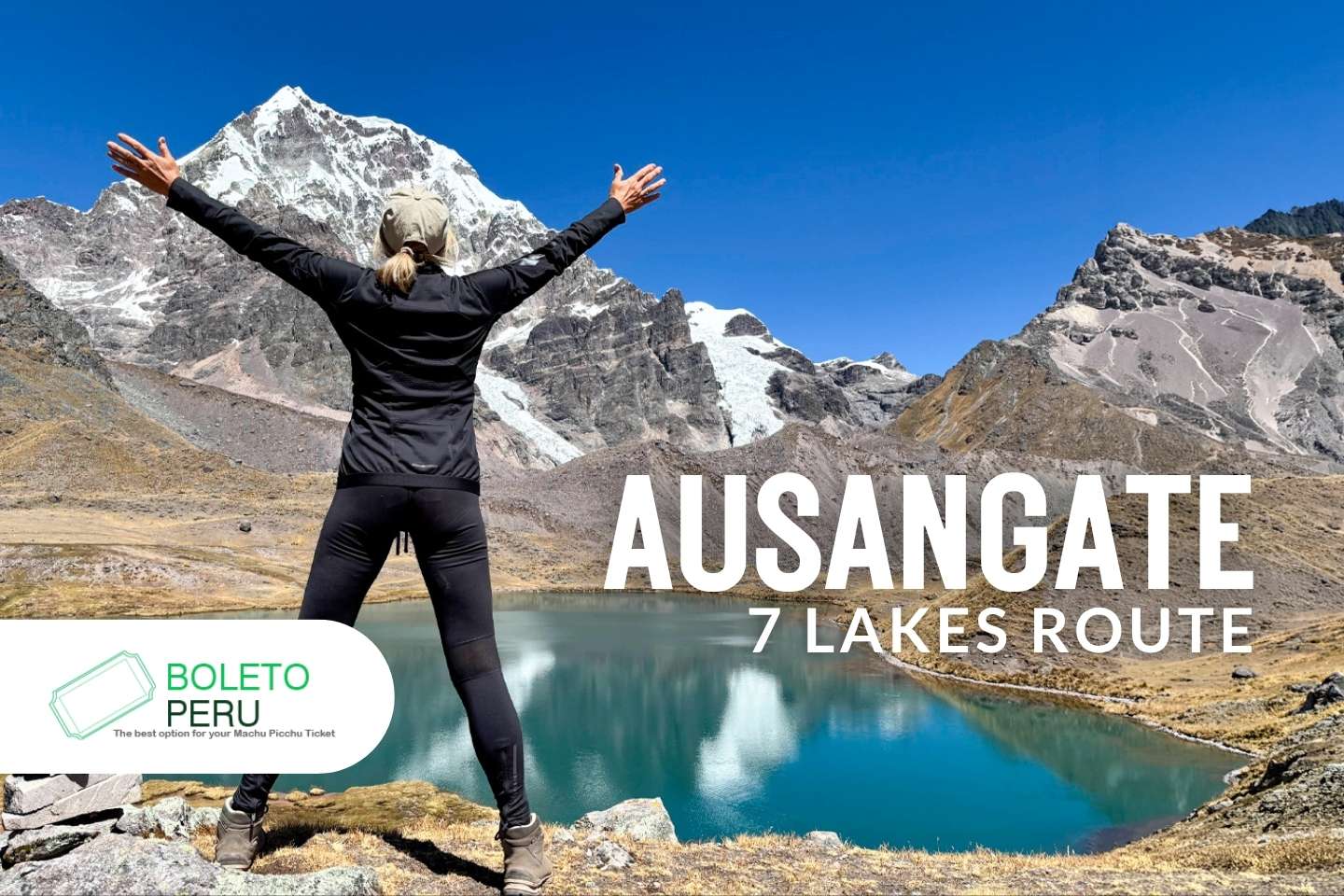
At over 5,000 meters high, in the Vilcanota Mountain Range, you can find the Ausangate snow-capped mountain, the highest peak in the Cusco region at 6,384 meters above sea level. Around it lies a trekking circuit that combines glaciers, high Andean ravines, and seven lakes of different colors, formed by the melting snow of the mountain and the minerals in the ground.
The route is located about 3-4 hours from the city of Cusco, in the Pacchanta district, within the Quispicanchi province. Unlike the classic Ausangate trek, which can take between 4 and 7 days for the full circuit, the 7 Lakes Route is a shorter choice that allows you to see a large part of the glacier landscape of the area in a single day, with no need to camp or have such demanding physical preparation.
In this guide we invite you to discover Ausangate, one of the most impressive mountains in the Andes and why it is considered a sacred apu for Andean communities. Also, we will tell you how the 7 Lakes Route is step by step, how long it takes to complete it, the best time to do it, what to bring, and how to get used to the altitude before going up.
What is the Ausangate?
Ausangate is a snow-capped mountain located in the Vilcanota Mountain Range, a mountain chain southeast of Cusco that marks the border between the Cusco and Puno regions. Administratively, it is in the Quispicanchi province, near the towns of Tinqui and Pacchanta. Also, this mountain range stretches for about 80 kilometers and includes about 469 glaciers, with Ausangate being its highest point.
Ausangate is a sacred apu for Andean communities.
For the Quechua communities of the area, this mountain is considered a protector of the animals and the people who live around it. This respect has roots that go back to the Inca Empire and is still alive in rituals and offerings that local families make to this day.
Altitude and features of the mountain
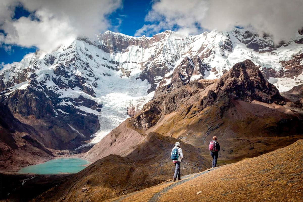
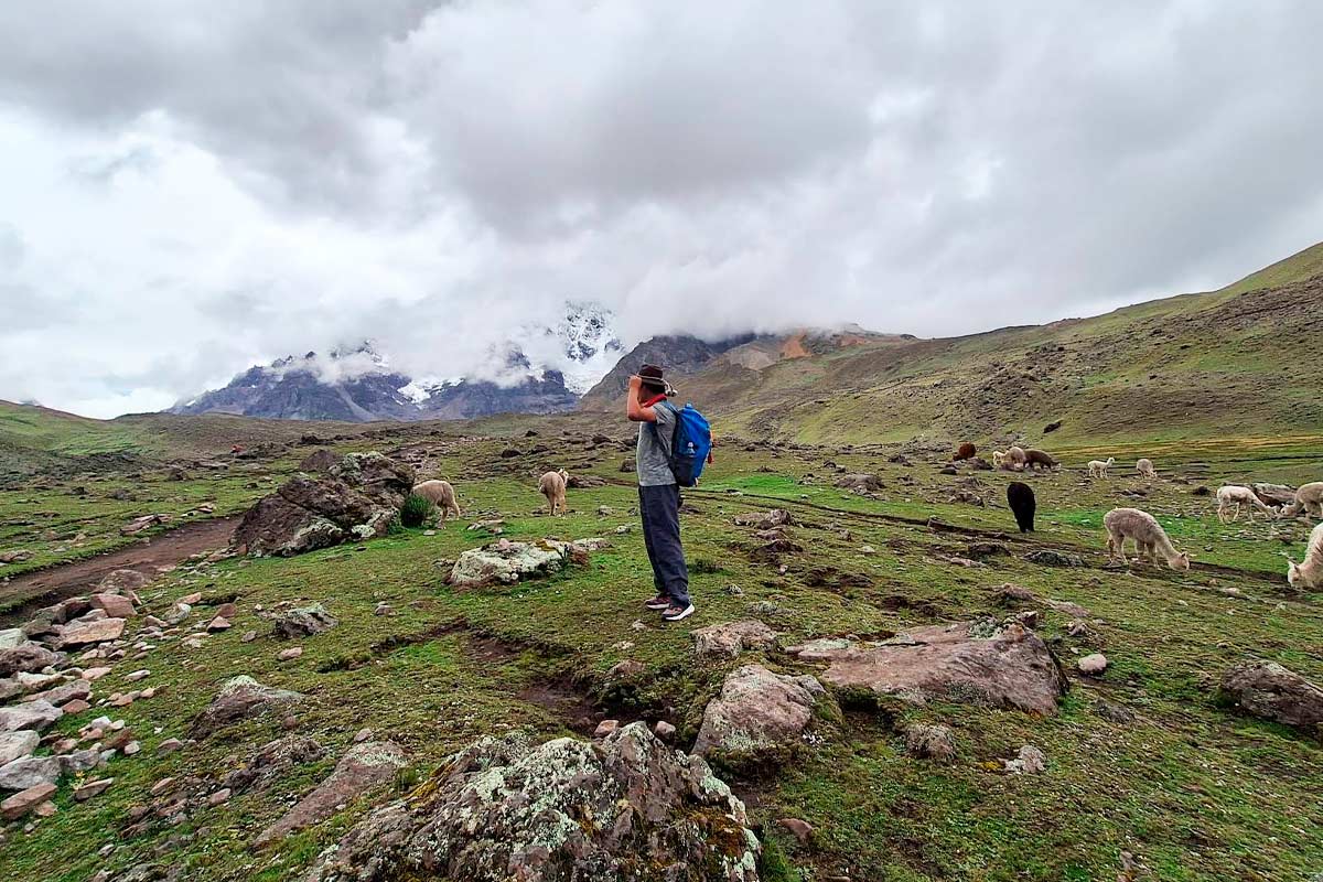
Ausangate reaches 6,384 meters above sea level, making it the highest mountain in the Cusco region. Its surroundings combine glaciers, moraines, glacier lakes, and high Andean wetlands that serve as pasture for camelids. Because of its altitude and the low temperatures in the area, snow and ice stay on the peak all year round.
What is the 7 Lakes Route?
The 7 Lakes Route is a one-day walk that visits seven lakes located on the slopes of the Ausangate snow-capped mountain, a short distance from the Pacchanta community. The circuit shows a large part of the typical landscape of the area: glaciers, wetlands, and waters with turquoise and blue colors.
Where are these lakes located?
The 7 Lakes are found around the Ausangate snow-capped mountain, in the Quispicanchi province, Cusco region. The circuit takes place at a high altitude, among mountain landscapes and snow-capped peaks that are part of the Vilcanota mountain range.
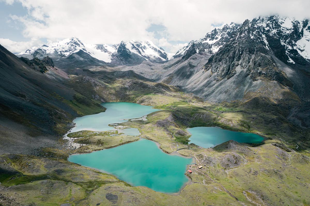
The lakes that are part of the circuit are: Superior Lake, Male Otorongo, Female Otorongo, Red Lake, Ccomer Lake, Blue Lake and Alqa Lake. All of them are in the same part of the mountain and are connected by trails that allow you to visit them during a walk.
Difference with the classic multi-day Ausangate trek
The classic Ausangate trek is a full circuit around the mountain that takes between 4 and 5 days, with nights in camps or in local lodges, and requires more physical preparation and logistics. The 7 Lakes Route, on the other hand, is a one-day version made for those who want to see the glacier environment of Ausangate without camping: it can be completed in a day of between 12 and 14 hours including the trip from Cusco, and does not require previous experience in multi-day trekking.
The seven lakes: name and features of each one
The 7 Lakes Route gets its name from the seven glacier lakes found along the circuit, each with its own color and surroundings. Below, each one is described in the order they are usually visited from Pacchanta:
- Upper Lake: It is one of the first lakes on the route. It is surrounded by rock formations and offers views of the snowy mountains that accompany a large part of the route.
- Male Otorongo: Its name refers to the otorongo (jaguar), an animal that in the Andean worldview is linked to strength. The lake is flanked by mountain slopes and is part of the same area as the Female Otorongo Lake.
- Female Otorongo: It is located near Male Otorongo, within the same section of the circuit. The color of its waters changes depending on the daylight and sky conditions, something common in the glacier lakes of the area.
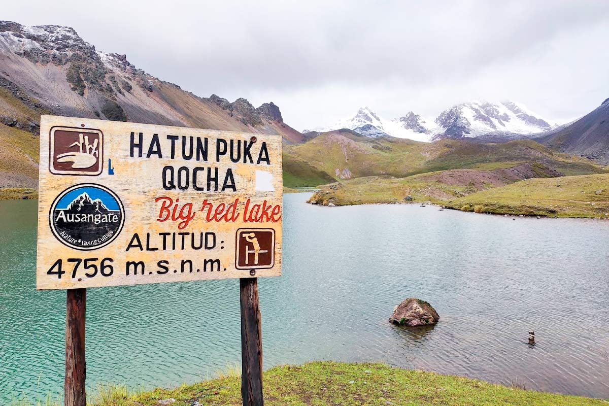
- Red Lake: It takes its name from the reddish and ochre tones seen in the surrounding land, a result of the soil’s mineral makeup. It is one of the points where the landscape changes the most compared to the rest of the circuit.
- Ccomer Lake: It has bluish and greenish tones and is surrounded by wider high Andean plains than the previous lakes, which makes it a good resting point during the walk.
- Blue Lake: As its name indicates, it stands out for the blue-turquoise color of its waters, typical of lakes fed by glacier melting.
- Alqa Lake: It is the last lake of the circuit before returning to Pacchanta. It is located in a more open section, with mountains and slopes typical of the high Andean landscape of the area.
What is the route like?: Step by step
The 7 Lakes Route follows a circular path that allows you to see each lake step by step, without having to walk back the same way. Below, we explain each section in detail.
Starting point and access from Cusco
The trek begins in Pacchanta, a small Andean community located at about 4,200-4,300 meters above sea level. To get there from Cusco, the car ride takes about 3 hours, passing through Urcos and Ocongate until reaching Tinki, from where a short detour leads to Pacchanta. Many travelers use this starting point to have breakfast with the local community before starting the walk, while the guide gives a brief explanation about the route and tips for the altitude.
Climbing section and main viewpoints
From Pacchanta, the trail moves forward crossing a puna landscape: open ground dotted with stones and wetlands, with a gentle but steady climb during the first kilometers. As you gain altitude, the first lakes begin to appear, and the path offers several natural viewpoints from which you can enjoy views of the Ausangate Snowy Mountain, its glaciers, and the surrounding valleys.
Highest point of the walk
The highest point of the circuit is usually located between 4,650 and 4,850 meters above sea level, depending on the exact route variation. From there you get the most amazing views of the whole trip: the Ausangate glaciers at a short distance and the group of colored lakes spreading through the valley. It is also the section where the altitude is felt the most, so it is recommended to move at a slow pace and stay well hydrated.
Descent and return
After reaching the highest point, the path begins to go down back to Pacchanta, closing the circular circuit. This section is usually faster than the climb, although just as scenic. Upon arriving back at the town, many trekkers use the Pacchanta hot springs to relax their muscles after the walk, a perfect end before starting the return to Cusco.
Duration and difficulty
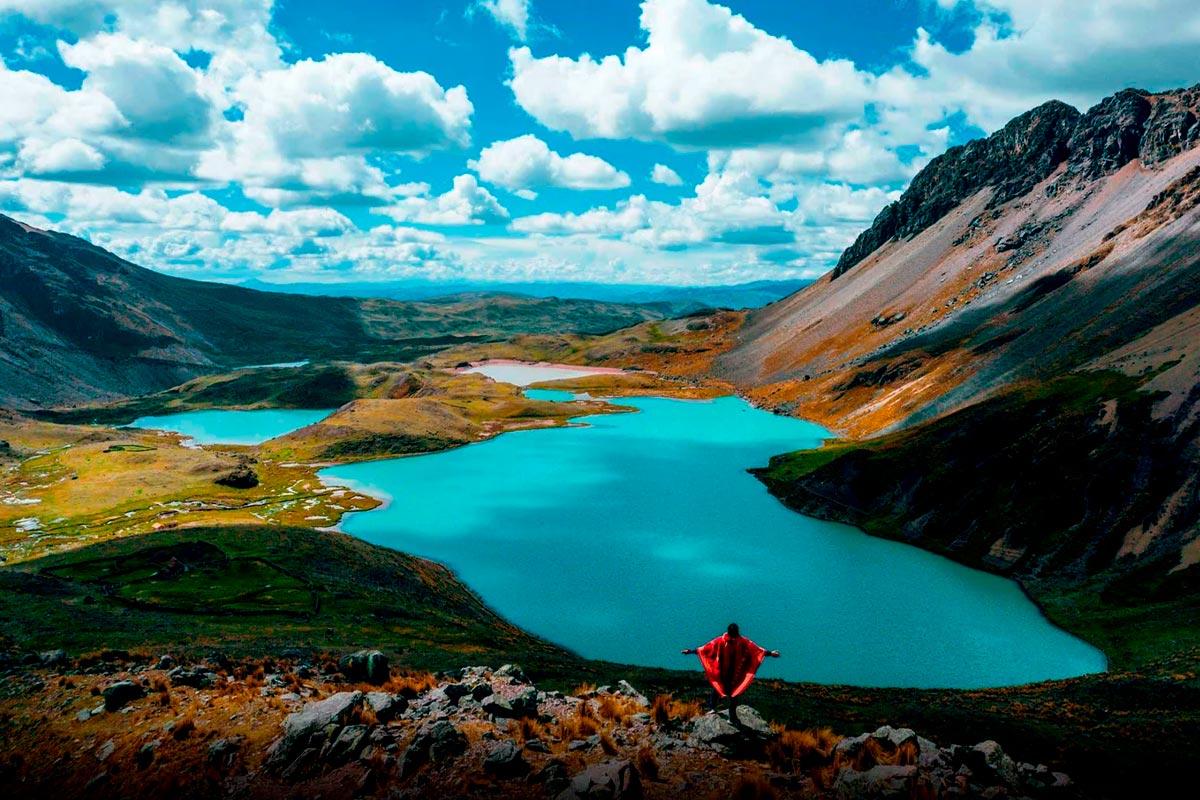
Can it be done in one day or does it need more time? Yes, the 7 Lakes Route is one of the few high mountain routes in the Ausangate area that can be comfortably finished in just one day. The walk itself takes between 5 and 6 hours, covering a loop of about 12 kilometers. Adding the trip from Cusco (about 3 hours there and another 3 back), the full day usually lasts between 14 and 15 hours, leaving the city very early and coming back late at night.
This clearly sets it apart from the classic Ausangate trek, which goes all the way around the snowy mountain and takes between 4 and 7 days of camping. The 7 Lakes Route, on the other hand, is the ideal choice for those who have limited time on their trip but do not want to miss the experience of walking next to a sacred mountain and its glacier lakes.
Physical demand level and recommended preparation
In terms of difficulty, it is a moderate to hard trek. The land itself does not have big technical drops or climbing parts, but the real challenge is the altitude: the whole route takes place between 4,200 and 4,850 meters above sea level, where the low oxygen level makes every step demand more effort than usual.
That is why, more than great physical fitness, what really makes the difference is good prior acclimatization. It is recommended to:
- Spend at least 2-3 days in Cusco (3,400 meters above sea level) before the walk, so the body can gradually adapt to the altitude.
- Stay well hydrated the days before and during the route, avoiding alcohol.
- Keep a slow and steady pace, without pushing yourself, especially in the final uphill section.
- Check with a doctor if you have a history of breathing or heart problems.
Best time to visit
The Ausangate area has two seasons, and picking the right time can completely change the walking experience.
The dry season, which runs from May to November, is the most recommended to do the 7 Lakes Route. During these months the skies are usually clear, which allows you to enjoy sharp views of the snowy Ausangate mountain and its glaciers, as well as firm and mud-free trails, ideal for safe walking.
The rainy season, between November and April, turns the landscape into a much greener and lush setting, with wetlands and grasslands at their most lively point. However, frequent rains make the paths slippery and harder to walk on, and it is common for fog to cover the snowy peak, reducing the view of the lakes and viewpoints. If your priority is photos and clear views, it is best to avoid these months.
Weather conditions and temperature in the area
Regardless of the season, the weather in the Ausangate area is cold and changing, typical of the high mountains. Some features to keep in mind:
- Cold and clear mornings: temperatures are usually around 0°C and 5°C when starting the walk, and can drop several degrees below zero during the night before in Pacchanta.
- Constant wind: the freezing air coming from the glaciers blows almost all the time, making the cold feel stronger even on sunny days.
- Strong sun during the day: despite the cold air, the sun’s radiation at this altitude is very strong, so it is common to feel hot during uphill sections while the air remains cold.
- Dry weather: humidity is low during the dry season, which can cause dehydration if you do not drink water often.
What to bring for the walk
Given the changing weather in the area (intense cold in the mornings, strong sun during the day and constant wind in the high parts), the key is to dress in layers. This is the essential gear that should not be missing from your backpack:
- Layered clothing: A thermal base layer, a fleece middle layer and a waterproof and windproof outer layer.
- Trekking boots: Preferably waterproof and with good grip, since the terrain includes sections of gravel, loose rocks and wet wetland areas.
- Warm hat or chullo, gloves and scarf: To protect from the freezing wind, especially in the highest parts of the loop.
- Sunscreen and sunglasses: The radiation at this altitude is very intense, even on cold days.
- Sun hat or cap: To add extra sun protection during the hours of greatest exposure.
- Trekking poles: Optional, but very useful to ease the load on your knees during the climb and descent.
- Water and energy snacks: Nuts, chocolate or energy bars to keep your energy level up during the 5-6 hours of walking.
- Swimsuit: If you plan to end the day in the Pacchanta hot springs.
- Camera: To capture the colorful lakes and the views of the snowy mountain from the viewpoints.
How to get there and tour options
There are two ways to do the 7 Lakes Route, and the choice depends on the time available and the comfort level you are looking for:
- Organized tour: It is the option chosen by most travelers, especially those who visit Cusco for a few days. It includes pick-up from the hotel, round trip transport, a professional guide, breakfast and lunch, and in many cases an emergency oxygen bottle. By leaving very early from Cusco, it is possible to complete the whole experience (walk, lunch and hot springs included) in a single day, returning to the city at night.
- Independent route: For those who prefer more freedom and flexibility, it is possible to get to Pacchanta on your own and walk the circuit without a guide. However, this means more planning time: public transport to the area is not direct, so many travelers choose to spend one night in Pacchanta before starting the walk the next day. It is a recommended option for those who already have experience in high altitude trekking and are looking for a more independent experience.
Transport from Cusco
The trip from Cusco to the starting point of the trek takes about 3 hours by vehicle. The route goes through Urcos and continues towards Ocongate, until reaching the town of Tinki, in the Quispicanchi province. From there, an extra 30-40 minute detour leads to Pacchanta, the exact point where the walk begins.
If you travel with an organized tour, transport is usually door to door, with direct pick-up from your hotel in Cusco very early in the morning (usually between 4:00 and 4:30 a.m.). If you prefer to go on your own, there are vans and public transport that cover the Cusco-Tinki route, although schedules are less frequent and it may be necessary to mix different transport options to get to Pacchanta.
