
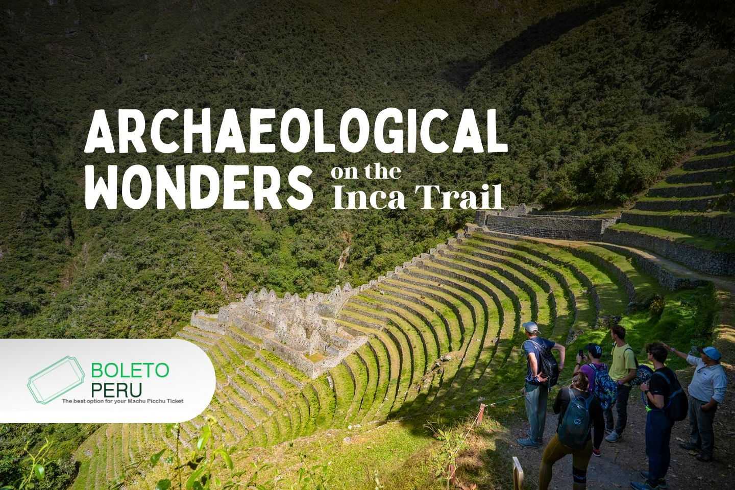
Inca Trail Peru – Did you know you can trek to Machu Picchu? Stay with us to explore and learn more about one of the most popular hikes in the world.
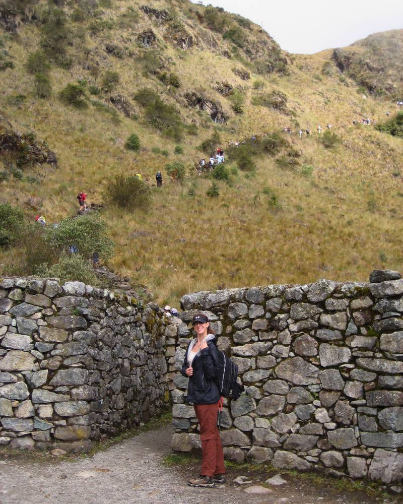
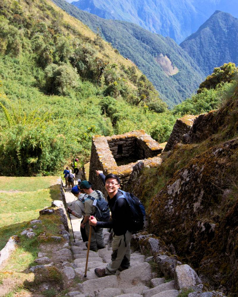
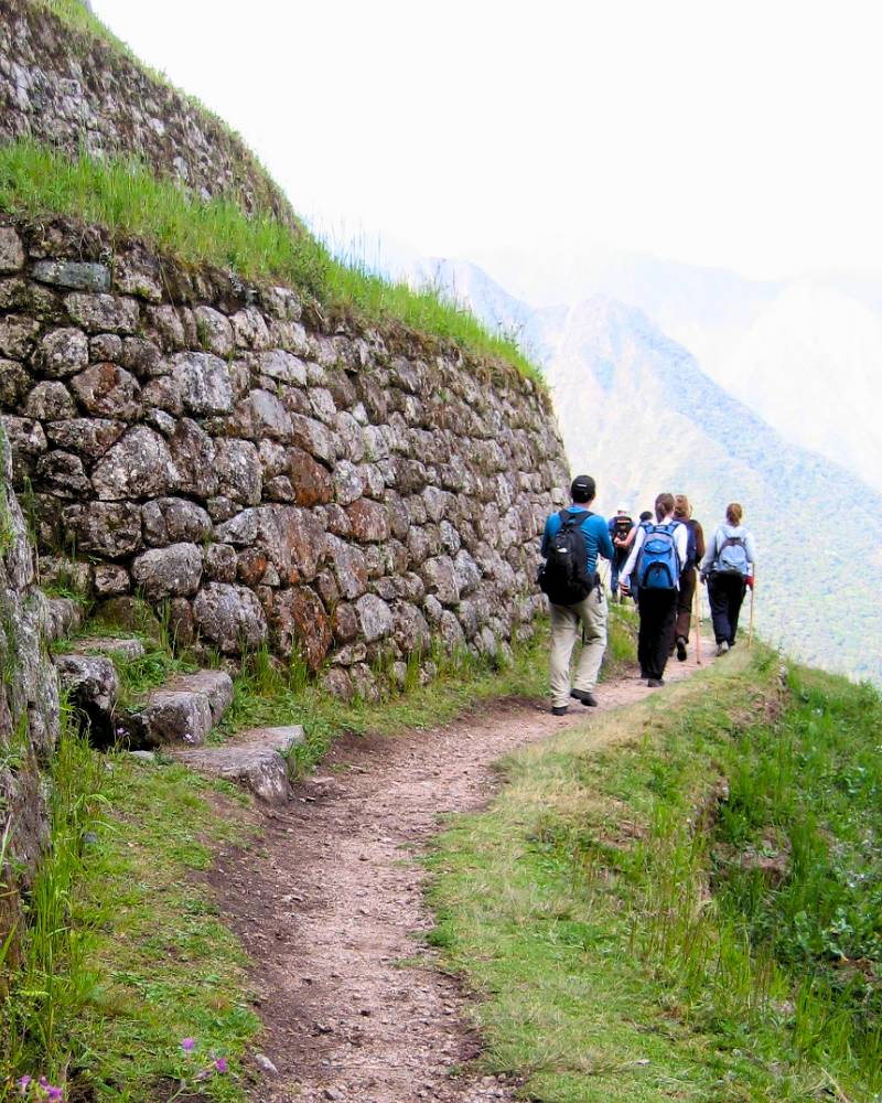
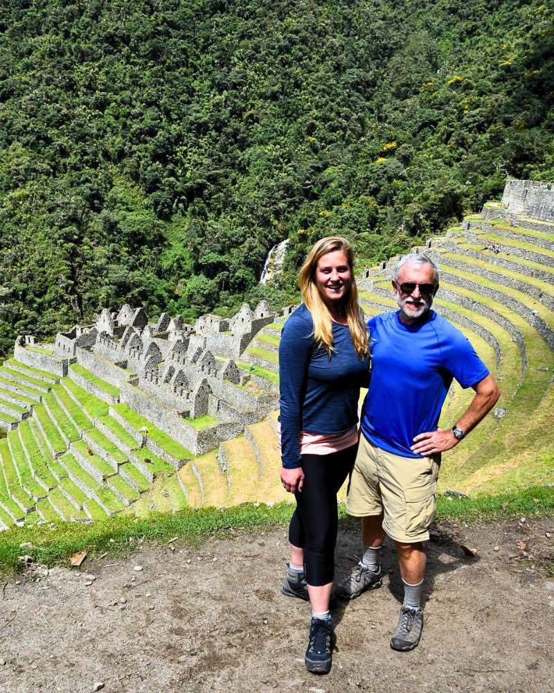
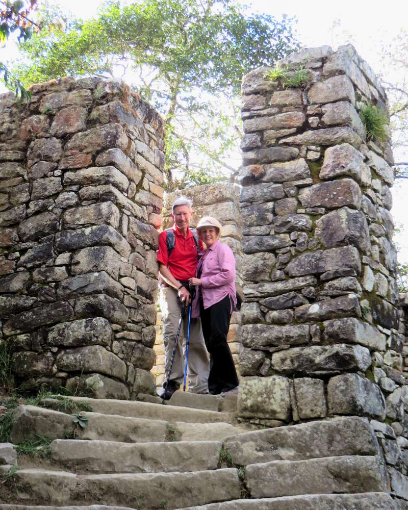
Trekking the Inca Trail to Machu Picchu is much more than just a hiking path, it’s an ancient trail that combines breathtaking scenery with the remains of one of the oldest civilizations in pre-Columbian America. For about 26 miles and four days of walking, travelers experience the magic of green cloud forests, high Andes mountains, and deep valleys, discovering along the way a series of old sites once used for farming, ceremonies, control, and lookout purposes.
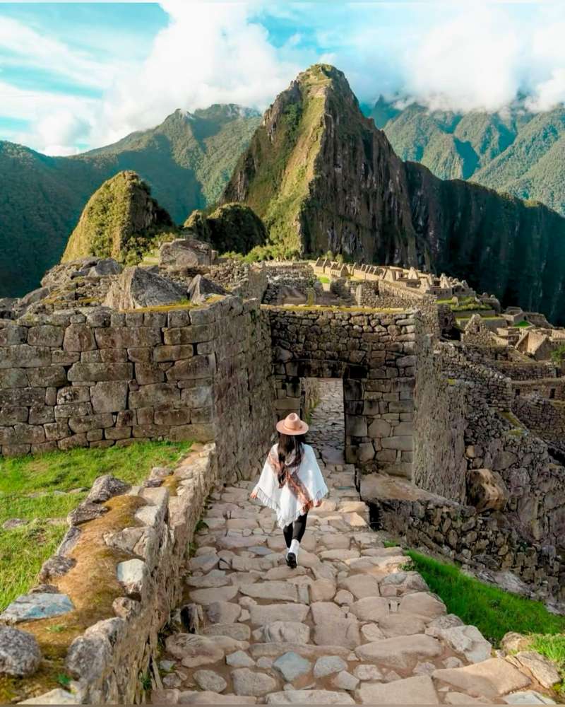
From the first terraces of Llactapata, where the Incas grew their food, to the grand Sun Gate (Inti Punku) that shows the arrival at the sacred city of Machu Picchu, every stone and every carved wall shows the skills that this old empire had and the deep connection that the Incas had with nature and the stars. Among these important places are round fortresses like Runkurakay, cities “above the clouds” like Phuyupatamarca, and farming and religious centers like Winay Wayna, all connected by a system of stone roads that follow the shapes of the mountains.
Here we will explore each of those old centers, giving you interesting facts about Inca engineering techniques and also, helpful tips for those who want to go on this adventure. Get ready to travel back in time and go into the heart of the Inca Empire, discovering secrets, stories and natural wonders that have lasted for centuries.
What is the Inca Trail to Machu Picchu?
The Inca Trail to Machu Picchu is a long path built by the Inca people between the 15th and 16th centuries. It was made to connect the center of the empire (Cusco) with the holy city of Machu Picchu. So, more than just a path, it’s a real road system (the Qhapaq Ñan) that let messengers, armies, pilgrims, and religious leaders move around, as well as carry farm and ceremony goods.
General Description
- Length: About 26 miles.
- Classic Length: 4 days of walking on average.
- Short Length: 2 and 3 days of walking on average.
- Altitude: Goes between 7,900 feet (km 82) and 13,800 feet (Warmiwañusca Pass).
- Terrain: Mixes cloud forests, high Andean grasslands, and mountain jungle.
Talking a little about what it did, the Inca Trail was a holy way for religious rituals to honor the Sun god (Inti) and other apus (holy mountains). It also helped to politically unite the people under Inca rule, make it easier to trade goods, and spread Andean culture. Each old site along the path worked as a tampu (inn), control center, or holy place, making the empire stronger.
Also, in 1983, UNESCO said the Qhapaq Ñan (including the Inca Trail to Machu Picchu) was a World Heritage Site, pointing out how special it is as proof of a road system from before the Spanish came that covered more than 18,600 miles. This recognition shows how important it is to keep not only Machu Picchu, but all the paths and old sites that make up the legacy of the Inca Empire.
How long does the Inca Trail last?
Walking the Inca Trail means getting used to the height, the Andean weather, and the pace of the route. There are 2 main ways to do it that differ in how long they take and how hard they are:
| DIFFERENCES | INCA TRAIL 4 DAYS | INCA TRAIL 2 DAYS |
| DISTANCE | 39 kilometers | 11 kilometers |
| DIFFICULTY | Medium – high | Medium |
| MAXIMUM HEIGHT | Warmiwañusca Pass (13,829 feet) | Intipunku (8,990 feet) |
| MINIMUM HEIGHT | Aguas Calientes (6,693 feet) | Aguas Calientes (6,693 feet) |
| CAMPING | 3 nights of camping | 1 night in Aguas Calientes hotel |
| GUIDE | Professional guide for 4 days | Professional guide for 2 days |
| ARCHAEOLOGICAL SITES | Llactapata, Runkurakay, Sayacmarca, Phuyupatamarca, Wiñayhuayna and Machu Picchu | Chachabamba, Wiñayhuayna and Machu Picchu |
INCA TRAIL ROUTES
Classic Inca Trail Peru
- Day 1: Km 82 – Wayllabamba (Initial getting used to the height and first time in the cloud forest)
- Day 2: Wayllabamba – Pacaymayo (Climbing to Warmiwañusca pass (13,780 feet), the highest point)
- Day 3: Pacaymayo – Wiñay Wayna (Going down through places like Runkurakay and Phuyupatamarca)
- Day 4: Wiñay Wayna – Machu Picchu (Sunrise at Inti Punku and arrival at the Inca city)
Short Inca Trail Peru
- Day 1: Cusco – Km. 104 – Aguas Calientes (Climbing through tropical scenery to Wiñay Huayna from where you continue to Machu Picchu and then to Aguas Calientes)
- Day 2: Aguas Calientes – Machu Picchu – Cusco (Departure by bus to the entrance gate of Machu Picchu and tour of the Inca City with your tourist guide. The return is by train and bus to the city of Cusco)
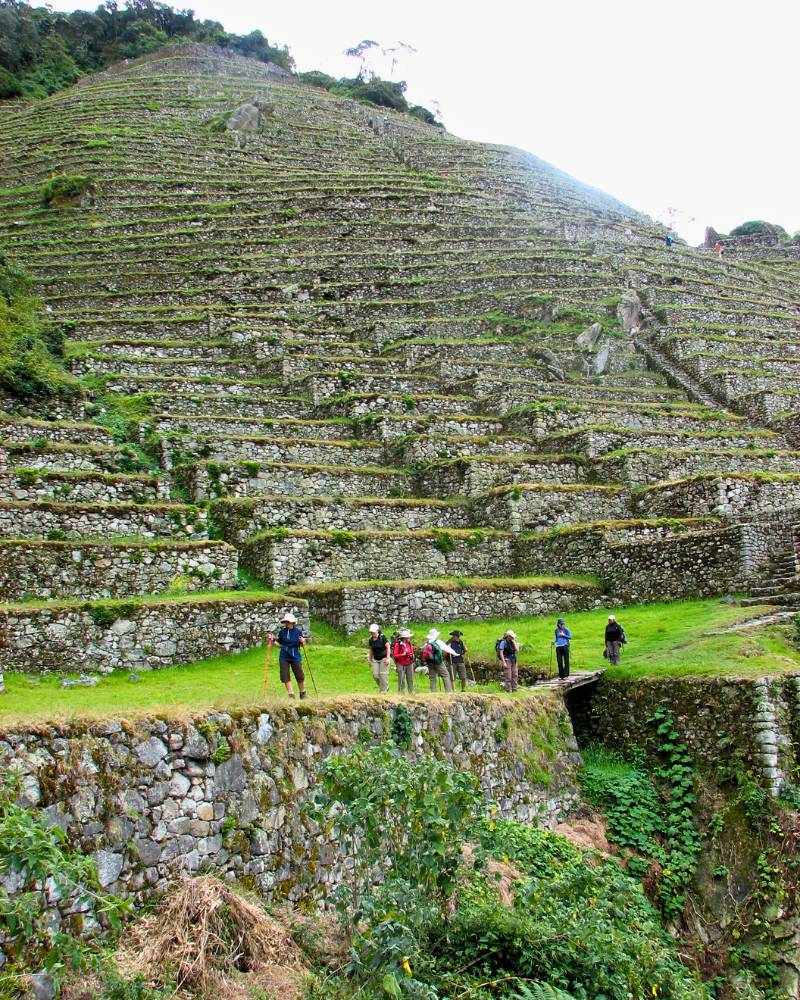
Archaeological Sites of the Inca Trail Peru
Llactapata |
This place, whose name in Quechua means “High Town” or “Town of the Terraces,” sits at 9,318 feet above sea level as proof of the Inca’s farming skill. Thanks to its wide stepped terraces, the Incas used the different small weather areas to grow corn, potatoes, and quinoa, allowing them to grow as much as possible in a mountain setting.
Besides its farming use, the design of its plazas and platforms suggests that it also held ceremonies related to the Pachamama (Mother Earth) and the apus (the gods of the land and mountains).
Important Fact: In 1912, just one year after his famous discovery of Machu Picchu (which is not too far from here in Cusco!), the explorer Hiram Bingham rediscovered Llactapata and described it in his diaries as a tampu (a resting station) key for supplying travelers and imperial messengers.
|
|
|
|

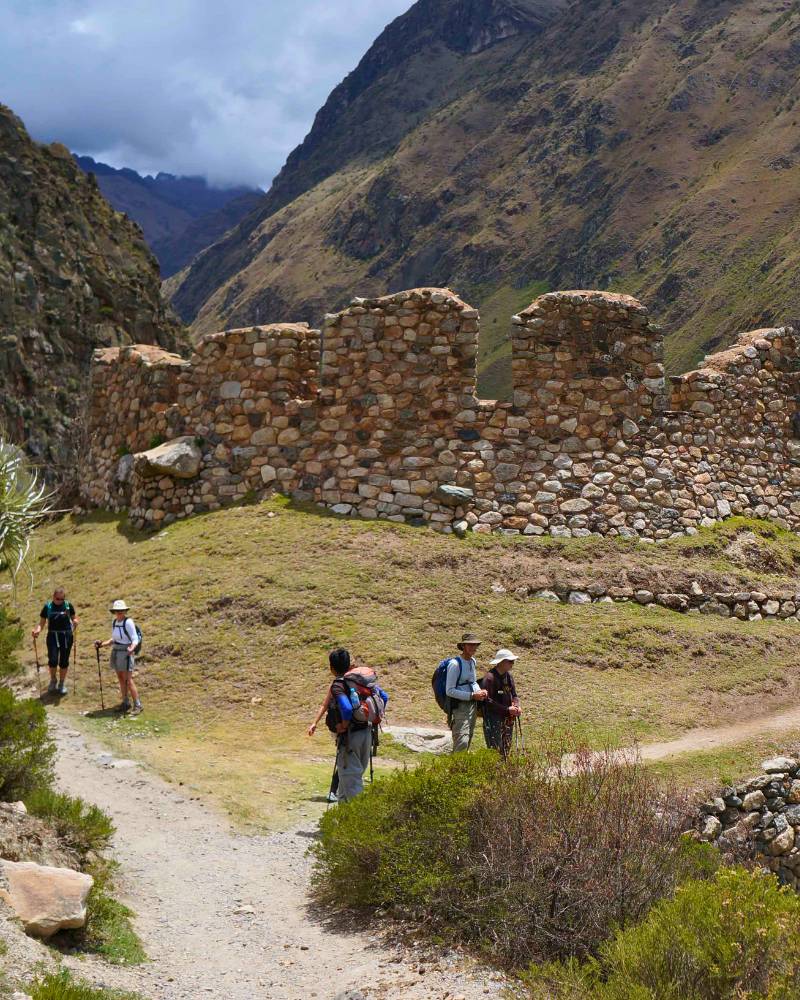
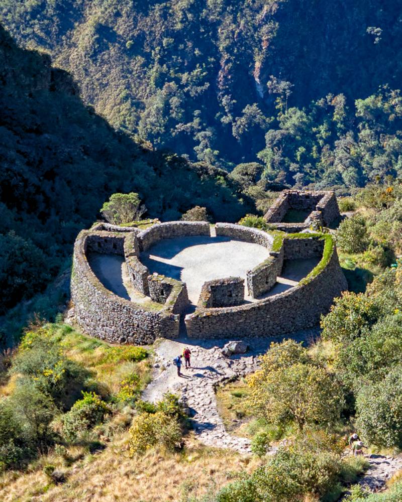
Runkurakay |
Runkurakay, “Pile of Ruins” in Quechua, is known for a half-circle structure perfectly built into the hillside at 12,336 feet above sea level. Its stone walls carved without mortar show the typical Inca style of precise fitting, with trapezoidal doors and niches that probably held offerings.
Also, the circular layout of its enclosures has led researchers to think that, besides being a tampu or checkpoint to watch traffic on the route, it might have worked as a religious retreat center for the elite or the priests of the sun worship.
|
|
|
|
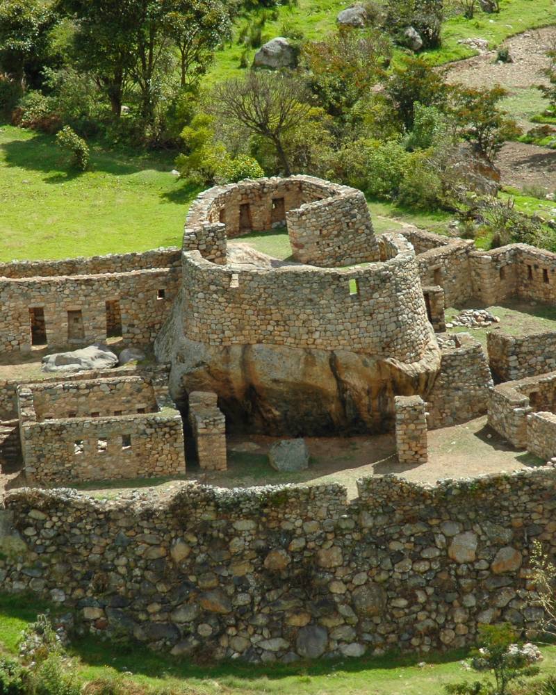
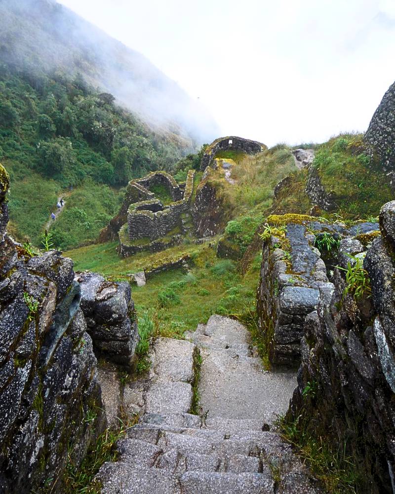
Sayacmarca |
Located at 11,811 feet above sea level on a narrow ridge, Sayacmarca (“Inaccessible Town”) amazes its visitors with its complex town planning. The site is divided into two parts: a living area with a maze of corridors and houses, and the Temple of the Sun, with terraces and canals that show an advanced knowledge of water systems for irrigation and sanitation. Because of this two-part nature, it is thought that its people were a self-sufficient community dedicated to both daily life and sun rituals.
Important Fact: In 1915, Hiram Bingham returned to the region (around Cusco, where we are now) and first called the site “Cedrobamba” because of the many cedar trees, although the original Quechua name was later recovered.
|
|
|
|
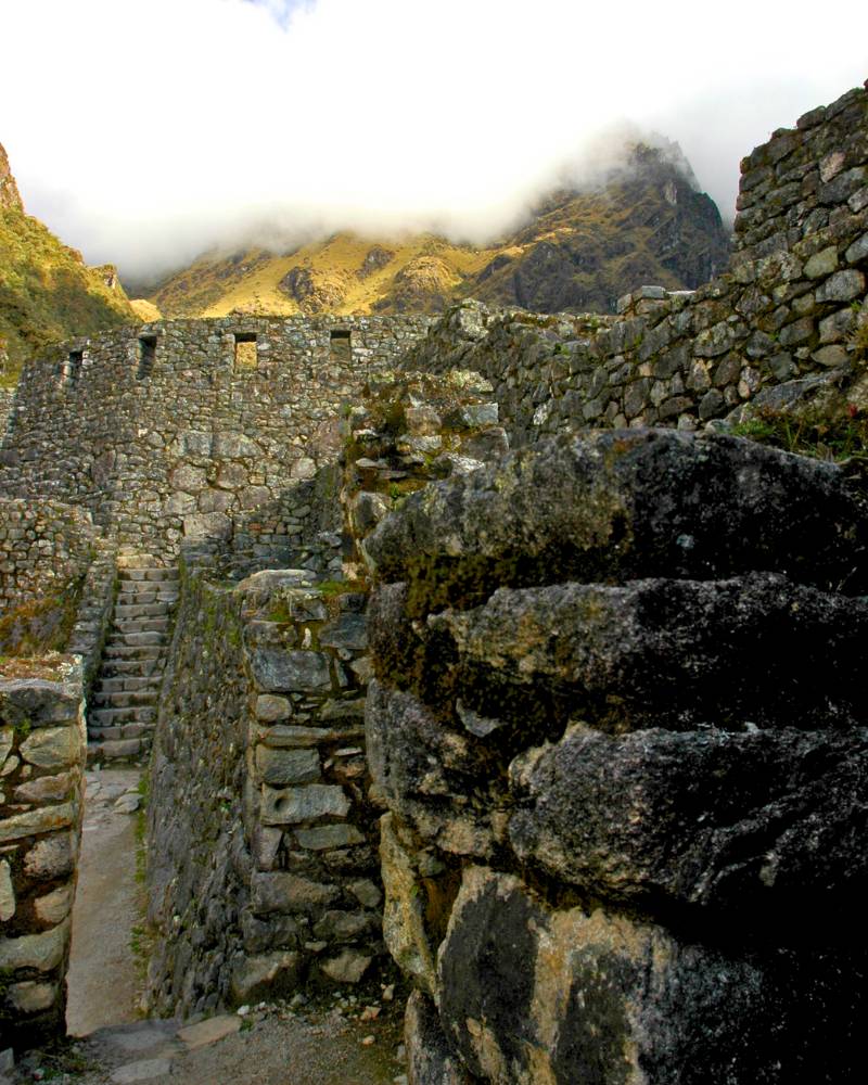
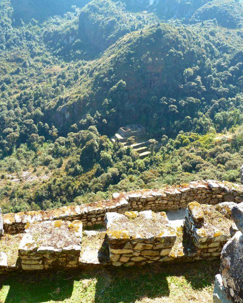
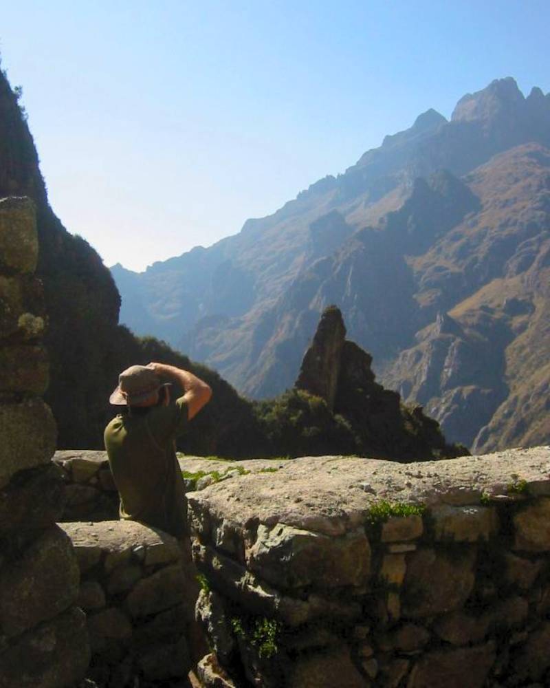
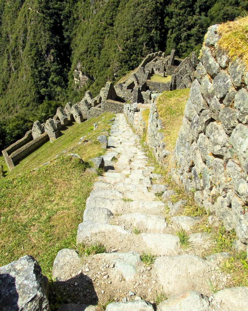
Phuyupatamarca |
This Inca center known as the “Town above the Clouds” in Quechua, is located at about 11,811 feet above sea level on a high point that overlooks the Urubamba Valley (which is a key part of the journey to Machu Picchu from Cusco). Its long terraces, dug into the hillside, not only allowed farming but also served as retaining walls to prevent landslides. The complex includes ceremonial baths (stone pools connected by canals) where ritual purifications with spring water were performed.
The water system of Phuyupatamarca is particularly impressive, as it is a network of canals carved in rock that carried water from nearby sources to the terraces and baths, controlling the flow with small stone gates.
|
|
|
|
Intipata |
This place, whose name means “Sun Terraces,” is a group of farming terraces carved into a steep hillside. In Inca times, these terraces were used to grow potatoes, corn, oca, quinoa, and coca leaves, using the sun and the changes in temperature.
Extra Fact: This area was also seen as a lookout point because of its good location. Intipata also worked as a viewpoint to watch the passing of groups and messengers. From there, they watched the part of the Inca Trail that leads to Machu Picchu, making sure the emperor’s travel was safe and organized.
|
|
|
|
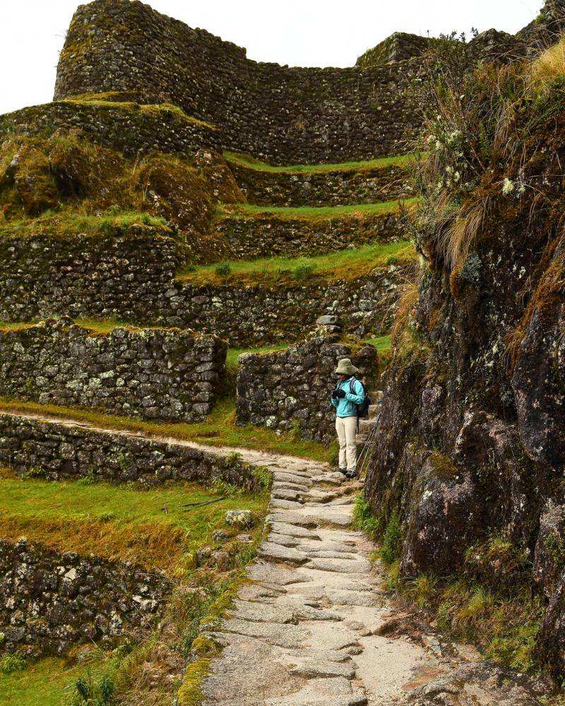
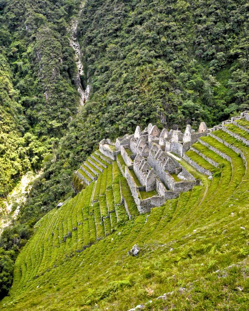
Wiñay Wayna |
A place that in Quechua means “Forever Young,” it is one of the most beautiful farming and religious areas on the Inca Trail Peru. Its stepped terraces go down in a half-circle shape, including small temples and water fountains.
Because of how its structure was built, it is thought that ceremonies related to the harvest cycle and the worship of Pachamama (Mother Earth) were done here, since water flowed constantly from its springs, showing the renewal and fertility of the land. Also, farmers and travelers gathered here to leave offerings before going on to Machu Picchu.
|
|
|
|
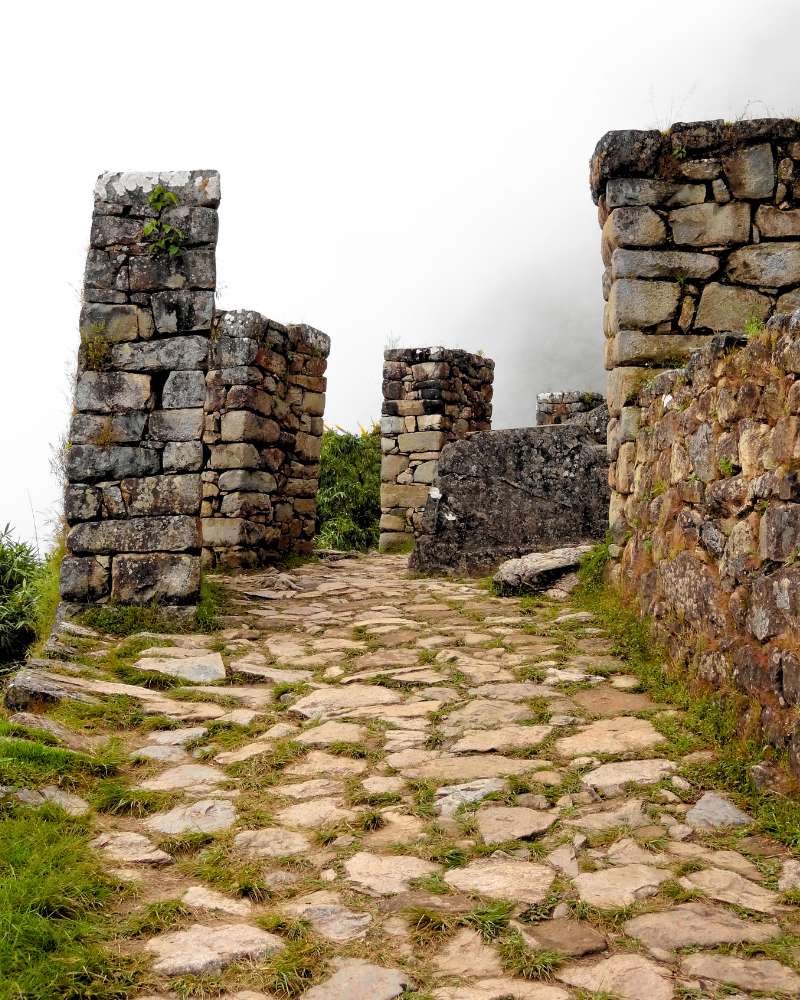
Inti Punku |
The Inti Punku, or better known as the “Sun Gate,” is built with fine stone blocks and is in a high place from which, at sunrise, the first rays of the sun light up Machu Picchu. This gate worked as a ceremonial arch: only through it could travelers see the citadel for the first time, in a symbolic act of connection with the god Inti (Sun).
Extra Fact: It is believed that celebrations of the winter solstice (June) were held at Inti Punku Sun Gate, when priests lined up stones to mark the point where the sun would rise, making offerings of grains and coca leaves to ensure good harvests.
|
|
|
|
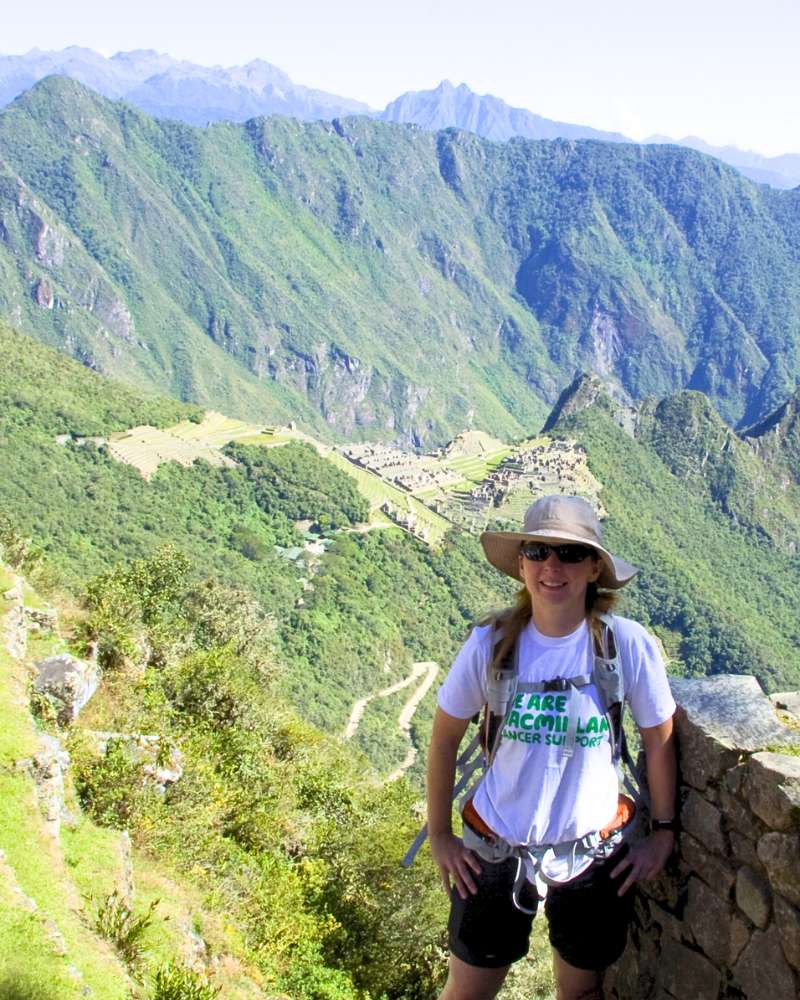
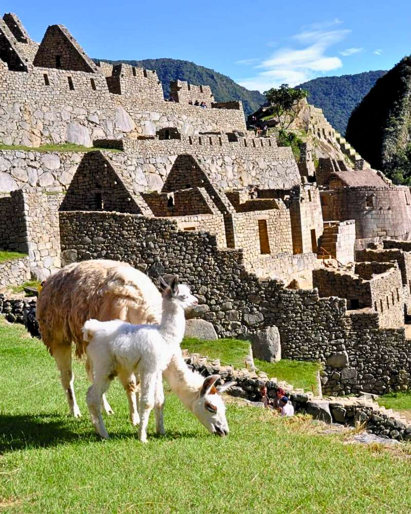
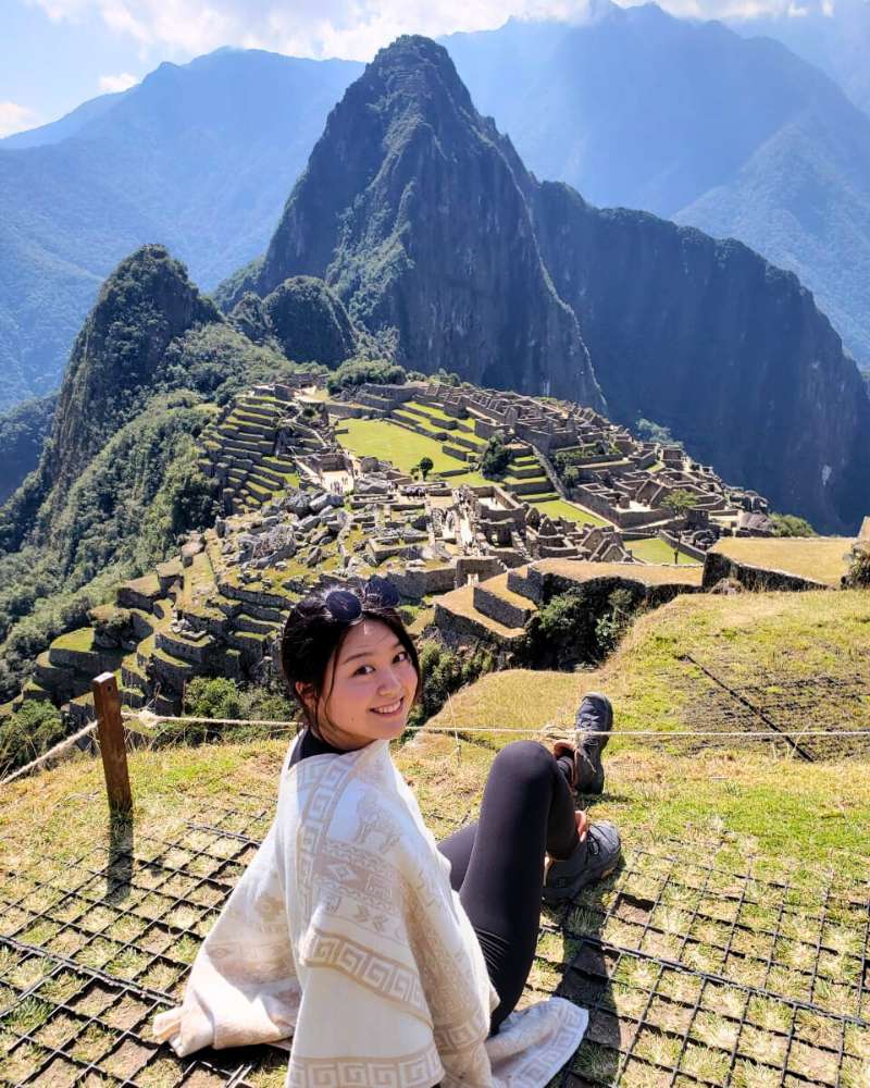
Machu Picchu |
Recognized by UNESCO as a World Cultural and Natural Heritage Site, the Inca city of Machu Picchu is the final destination of the Inca Trail and the architectural jewel of the Inca Empire. Located at 7,972 feet above sea level, it combines ceremonial, residential, and farming areas in perfect harmony with the landscape.
Today, the purpose of this place is unknown, so it remains a fascinating mystery in the Cusco region. Its temples, terraces, walls, palaces, and structures leave visitors and experts alike speechless. Also, its construction and the precision in the carving of its stones amaze those who decide to visit this place.
|
|
|
|
Curiosities and Interesting Facts
The Incas solved problems of height and slopes using building ideas that still surprise us today because they worked so well and lasted so long. So, these old buildings left us with some questions:
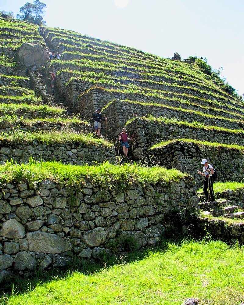
How were roads and terraces built at high altitudes?
To build the farming terraces carved into almost straight-up hillsides, the Incas first put a base of big rocks that acted like a wall to hold things in. On top of this base, they added a layer of smaller stones and, finally, good soil brought from lower valleys.
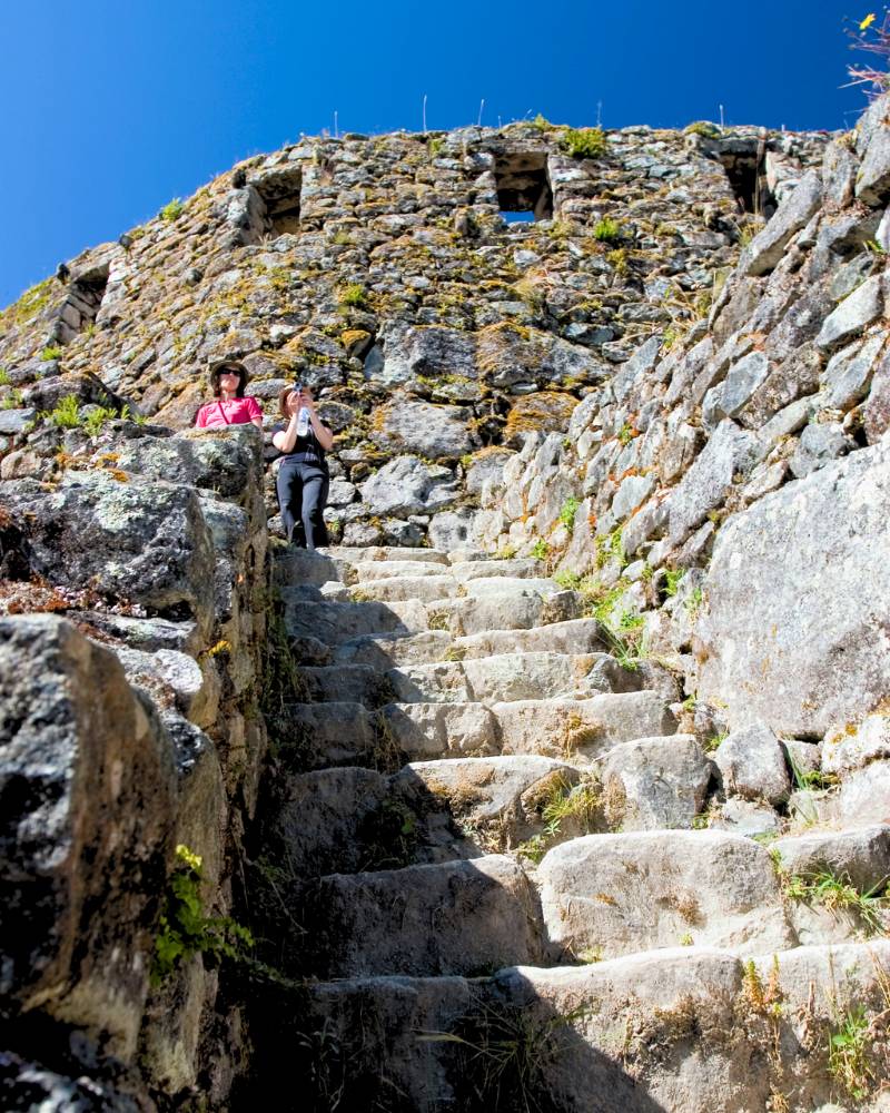
In the steepest parts of the old Inca trail, the Inca builders came up with amazing building solutions. Whether they carved steps right into the hard rock or built stairs with blocks joined together with great care, these methods made sure the path was strong. This way, both travelers and animals carrying loads could walk with relative ease over difficult land.
What building techniques did the Incas use?
The main road of the Qhapaq Ñan mixed sections paved with rock slabs and sections of packed earth made stronger with gravel. In areas with steep slopes, they built walls to hold the land and put in drainage systems (side channels and stone pipes) to carry away rainwater and prevent landslides.
The Inca builders managed to put together stone walls without using mortar (cement). Each block was carefully shaped, like it was part of a giant puzzle, so that they fit together so perfectly and were so stable that they could withstand earthquakes. On the other hand, to cross deep valleys and strong rivers, the Incas invented hanging bridges made of fibers like ichu, a grass that grows in the Andes. A living example of this old building skill is the Q’eswachaka, seen as the last Inca hanging bridge that is still kept and rebuilt every year by the local communities.
Unique plants and animals found during the walk
Spanning from mountain woodlands to the fringes of the jungle, the Inca Trail boasts a rich array of flora, featuring more than 400 orchid varieties like the Cantuta, a selection of begonias, and notable trees such as the queuña (Polylepis racemosa) and the pisonay (Erythrina falcata).
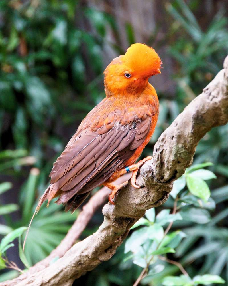
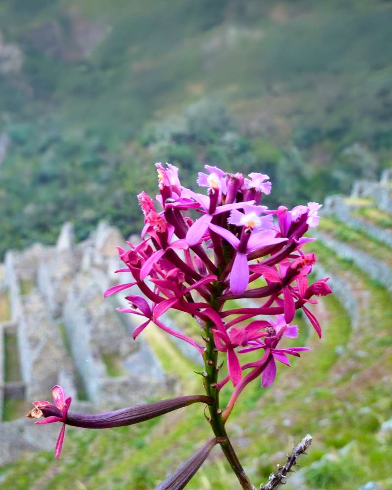
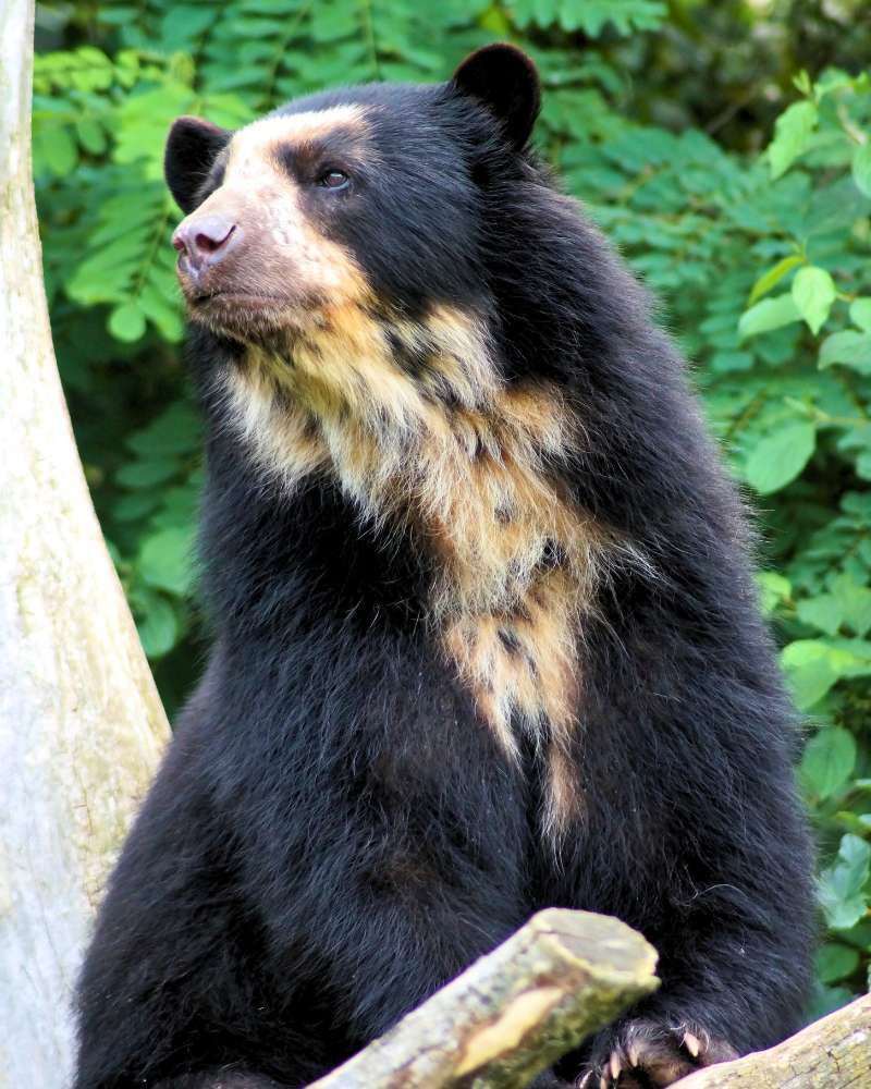
Among the natural Andean animals on the Inca trail, you can see the iconic cock-of-the-rock (the national bird of Peru). We can also find the spectacled bear, the only bear native to South America. Also, as it’s the path to the Inca city, we can see colorful butterflies and the quick presence of small mammals like the chinchillón, which makes this ecological area even richer.
|
COCK OF THE ROCK
|
WIÑAY WAYNA ORCHID
|
SPECTACLED BEAR
|
Tips for Hiking the Inca Trail Peru
The Inca Trail experience includes confronting the high altitude, adapting to weather shifts, and undertaking a moderately challenging hike. These tips will help you get ready and enjoy the experience a lot.
Best time to go (dry season)
The dry season in the Peruvian Andes is from May to September. During these months, there is very little rain, the paths are more stable, and the skies are usually clear, giving amazing views and clear sunrises at Inti Punku. July and August are the most popular, so you will see more tourists, and it is very important to book the official permits many months ahead of time.
Tips for getting physically ready
- Get used to the altitude first: Arrive in Cusco at least 2–3 days before to lower the chance of altitude sickness. Walk around the city and take easy walks up to 9,800 feet.
- Cardio training: Do long walks. You can take a city tour around Cusco before the trip.
- Strength and balance work: Do leg exercises (like squats) to get better balance on uneven ground.
- Practice with weight: Get your body accustomed to carrying weight by practicing walks with a backpack weighing 15–22 pounds, simulating what you’ll carry on the trail.
Essential gear
- Day backpack (8 gallons) with rain cover.
- Good hiking shoes, waterproof boots with good grip.
- Clothes in layers like a breathable shirt, fleece, and windproof/water-resistant jacket.
- Sleeping bag (comfortable down to at least 32°F)
- Trekking poles that make less stress on your knees and give better balance.
- Sun protection like a hat, UV glasses, and high SPF sunscreen.
- Reusable water bottle and water purifying tablets.
- Basic first-aid kit with bandages, pain relievers, altitude sickness pills, and disinfectant.